
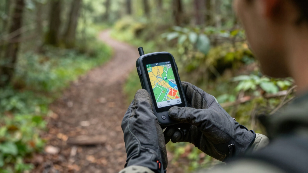
When venturing into the backcountry, a reliable handheld GPS is essential for navigation and safety. The best units combine durability, precise positioning, and user-friendly interfaces. The Garmin GPSMAP 65s stands out as the overall top pick thanks to its multi-band technology and expanded satellite support, making it dependable in challenging environments. For lighter needs, the Garmin inReach Mini 2 offers satellite communication in a compact form, though it sacrifices some navigation features. Meanwhile, rugged survey-grade options like ZL180 excel for land measurement but are less suited for casual hikers. Keep reading to explore these options and find the best fit for your backcountry adventures.
Key Takeaways
- Multi-band and multi-GNSS support significantly improve accuracy in challenging terrain.
- Durability and water resistance are non-negotiable for backcountry use, favoring rugged models.
- Compact size and weight matter for long hikes, but often come with tradeoffs in screen size and battery life.
- Integrated satellite communication (like inReach) adds safety features but reduces emphasis on pure navigation functions.
- Price varies widely, with dedicated land surveying devices costing more but offering higher precision, while rugged hiking units balance durability with affordability.


More Details on Our Top Picks
Garmin GPSMAP 65s, Button-Operated Handheld with Altimeter and Compass, Expanded Satellite Support and Multi-Band Technology, 2.6″ Color Display
This model stands out for its combination of multi-band technology and expanded GNSS support, providing reliable accuracy even under dense canopy or steep terrain where other devices like the eTrex 32x might struggle with signal loss. Its 2.6″ sunlight-readable color display ensures clear visibility in bright conditions, and its robust construction makes it suitable for rough outdoor use. Unlike the GPSMAP 65, the 65s includes an electronic compass and barometric altimeter, which are invaluable for precise navigation and elevation tracking in mountainous environments. The device’s long battery life—over 23 hours in GPS mode—further enhances backcountry reliability, especially when paired with replaceable batteries like AA NiMHs. However, its higher price point and slightly heavier weight could be drawbacks for ultralight backpackers or budget-conscious users. This pick makes the most sense for serious outdoor enthusiasts who need accuracy, durability, and extended use without sacrificing usability.
Pros:- Multi-band and multi-GNSS support for superior accuracy in challenging environments
- Long battery life exceeding 23 hours with AA NiMH batteries
- Rugged, water-resistant design with a sunlight-readable 2.6″ display
- Includes an electronic compass and barometric altimeter for precise navigation and elevation data
Cons:- Relatively high cost may deter budget-minded users
- Heavier and bulkier than smaller handheld options like the eTrex 32x
- Requires AA batteries or external power for extended use, which can be inconvenient
Best for: Backcountry hikers, mountaineers, and search-and-rescue teams who require high accuracy and rugged reliability.
Not ideal for: Casual campers or day hikers who prefer lightweight gear and less technical features, since it may be overkill for short outings.
- Screen Size:2.6 Inches
- Battery Type:AA (NiMH recommended)
- Battery Life:Over 23 hours in GPS mode
- Support:Multi-GNSS, Multi-band
- Water Resistance:Yes
- Includes:Altimeter, Compass
Bottom line: This device is ideal for those who prioritize accuracy, durability, and comprehensive features for serious backcountry navigation.
ZL180 Handheld GPS for Surveying, High Precision Rugged Land Surveying Equipment for Ranches, Garden, Farmland and Parking Area Distance Measuring
This device excels in precise land measurement tasks rather than navigation, making it a specialized tool compared to multi-purpose GPS units like the GPSMAP 65s. Its high sensitivity GPS and GLONASS support, coupled with a very low error margin (0.003 acres), deliver exceptional accuracy for land surveying, agricultural planning, or construction site assessments. The rugged, compact design and backlit LCD ensure durability and visibility in outdoor settings, but it lacks waypoint storage and navigation features that are standard on backcountry GPS units. Its focus on straight and curved line distance measurement means it’s less suitable for orienteering or trail navigation. The device’s primary limitation is that it cannot save waypoints or provide route guidance, which could be a significant drawback for outdoor explorers. It’s best suited for land surveyors, farmers, and land developers needing high precision rather than general navigation.
Pros:- Exceptional accuracy with a margin of error as low as 0.003 acres
- Rugged, compact, and easy to hold with backlit LCD display
- Supports both straight and curved line distance measurements
- High sensitivity GPS and GLONASS for reliable signals in open outdoor areas
Cons:- Limited to land measurement; no waypoint saving or route guidance
- Not suitable for navigation or backcountry trail use
- No microSD support or advanced mapping features
Best for: Land surveyors, farmers, and land developers needing precise land and distance measurements in outdoor environments.
Not ideal for: Hikers, backpackers, or outdoor adventurers seeking navigation, route plotting, or waypoint management, as this device lacks those functions.
- Display Size:2.4 Inch
- Support:GPS + GLONASS
- Accuracy:0.003 acres error
- Measurement Modes:Area, Straight, Curved
- Weight:180g
- Battery:Not specified
Bottom line: This device is best for land measurement professionals who need high-precision land and distance data, not for navigation in wilderness settings.
Garmin inReach Mini 2, Lightweight and Compact Satellite Communicator, Hiking Handheld, Black
This device makes the list for its combination of lightweight design and reliable global satellite communication, ideal for backcountry explorers who need emergency SOS and two-way messaging. Compared to dedicated GPS units like the GPSMAP 65s, the inReach Mini 2 offers no onboard navigation but excels in providing peace of mind through interactive SOS, GPS tracking, and location sharing, especially in areas with no cell coverage. Its 14-day battery life in tracking mode and compact size—small enough to fit in a pocket—are major advantages for ultralight travelers. Its primary tradeoff is that it lacks detailed maps or navigation features; instead, it relies on pairing with a smartphone app for planning and topographical data. This device is perfect for solo hikers, adventure travelers, or search-and-rescue teams needing a dependable emergency communication tool.
Pros:- Lightweight and pocket-sized for easy carry
- Global two-way messaging and interactive SOS (subscription required)
- Battery life up to 14 days in tracking mode
- Pairing with Garmin Explore app for trip planning and location sharing
Cons:- No onboard maps or navigation features
- Requires active satellite subscription for full functionality
- Limited to communication and emergency features, not navigation
Best for: Backcountry hikers, hunters, and adventure travelers who prioritize emergency communication and SOS capabilities over detailed navigation.
Not ideal for: Users who need full navigation features or detailed maps, as this device does not support onboard mapping or route planning.
- Size:1.27 Inches
- Battery Life:Up to 14 days
- Communication:Two-way messaging, SOS
- Support:Satellite, Bluetooth
- Weight:99 grams
- Included:USB Cable, Documentation
Bottom line: Ideal for those who want a reliable emergency SOS device combined with compact size, rather than full navigation capabilities.
Garmin GPSMAP 65, Button-Operated Handheld with Expanded Satellite Support and Multi-Band Technology, 2.6″ Color Display, 010-02451-00
While not as feature-rich as the GPSMAP 65s, the GPSMAP 65 provides solid performance for general outdoor navigation, especially for users seeking a straightforward, button-operated device. Its 2.6″ sunlight-readable display ensures visibility in bright conditions, and its multi-GNSS support improves signal reception in steep or forested terrain where other GPS units may falter. Compared to the more advanced GPSMAP 65s, it lacks an electronic compass and barometric altimeter but still offers preloaded TopoActive maps and the ability to review trip data via the Garmin Explore app. Its battery life exceeds 20 hours in typical use, making it suitable for longer excursions. The device’s simplicity and reliable performance make it ideal for casual hikers and outdoor enthusiasts who don’t need ultra-precise sensors or multi-band technology.
Pros:- Reliable multi-GNSS support for better signal reception
- Simple button interface for glove-friendly operation
- Preloaded topographic maps and public land data
- Good battery life over 20 hours
Cons:- Lacks electronic compass and barometric altimeter
- Less advanced sensors compared to the 65s
- No microSD support for additional mapping
Best for: Casual hikers and outdoor enthusiasts seeking a dependable, easy-to-use GPS device for day trips and moderate backcountry use.
Not ideal for: Serious mountaineers or technical outdoor professionals who require multi-band, multi-GNSS support, or sensors like a barometric altimeter.
- Screen Size:2.6 Inches
- Battery Life:Over 20 hours
- Support:Multi-GNSS
- Display:Sunlight-readable LCD
- Support Maps:Preloaded TopoActive
- Weight:Approximately 0.48 pounds
Bottom line: This device suits outdoor users who want dependable navigation without extra bells and whistles, perfect for everyday outdoor activities.
Garmin Garmin Drive™ 53 GPS Navigator, High-Resolution Touchscreen, Simple On-Screen Menus and Easy-to-See Maps, Driver Alerts
This GPS is tailored specifically for road navigation rather than backcountry exploration, but it’s included here for its clarity and ease of use. The 5″ high-resolution touchscreen makes it easy to see routes and alerts, with driver-focused features like lane guidance, school zone warnings, and upcoming city or landmark notifications. Unlike handheld GPS units like the GPSMAP 65s, its primary function is on-road navigation with detailed maps and real-time alerts. Its user-friendly interface and comprehensive points of interest make it excellent for driving trips, but it’s unsuitable for wilderness navigation or off-road use. The device’s limited battery life—around 1 hour—means it must be plugged into power during long drives, unlike rugged outdoor GPS units.
Pros:- Bright, high-resolution 5″ touchscreen display
- Simple on-screen menus and clear maps
- Includes driver alerts for safety and situational awareness
- Points of interest like restaurants, fuel, and parks
Cons:- Limited to vehicle and road navigation; not suitable for outdoor hiking
- Very short battery life—about 1 hour without power source
- No off-road or topographical features
Best for: Road trip travelers and daily drivers who need clear, simple navigation and driver alerts.
Not ideal for: Backcountry hikers or outdoor adventurers seeking rugged, multi-sensor GPS units, as this device focuses on vehicle navigation and not wilderness use.
- Screen Size:4.97 Inches
- Display Type:Capacitive Touchscreen
- Battery Life:Approximately 1 Hour
- Map Support:North America, includes updates
- Connectivity:USB, Bluetooth
- Additional Features:Driver alerts, TripAdvisor ratings
Bottom line: This device is excellent for drivers and road trip enthusiasts who value simplicity and clear visuals but is unsuitable for backcountry navigation.
Garmin inReach Mini 2, Lightweight and Compact Satellite Communicator, Hiking Handheld, Orange – 010-02602-00
This device excels at providing reliable satellite communication in remote areas, making it an essential choice for backcountry travelers who prioritize safety. Unlike traditional GPS units like the Garmin eTrex® SE, which focus on navigation, the Garmin inReach Mini 2 offers two-way messaging and interactive SOS, ensuring you can contact help even when maps and signals fail. Its compact, lightweight design makes it ideal for attaching to gear without adding bulk. The tradeoff is that this device requires an active satellite subscription, adding ongoing costs, and it lacks detailed mapping features—so it isn’t the best standalone navigation tool. Compared to the Garmin GPSMAP 65, which offers advanced mapping, the Mini 2 is better suited to users who need communication rather than detailed trail data. This pick makes the most sense for solo adventurers or groups venturing into areas with no cell service where safety is a priority.
Pros:- Enables two-way messaging and interactive SOS for peace of mind
- Compact and lightweight, easily attaches to gear
- Syncs with Garmin Explore app for trip planning and topographical mapping
Cons:- Active satellite subscription required, adding ongoing costs
- Lacks detailed maps or navigation features, relying on external apps for route planning
Best for: Backcountry travelers who need reliable satellite communication for safety and emergency contact, especially solo hikers or remote expeditions.
Not ideal for: Hikers who want detailed topographical maps and navigation features without additional subscriptions or communication capabilities.
- Battery life:up to 14 days in tracking mode
- Connectivity:Bluetooth, Satellite
- Water resistance:Yes
- Special features:Interactive SOS, MapShare, digital compass
- Dimensions:Compact, lightweight
- Maps included:None (sync via app)
Bottom line: This device is perfect for safety-focused users who need reliable satellite communication in the backcountry.
Garmin 010-02256-00 eTrex 22x, Rugged Handheld GPS Navigator, Black/Navy
This model stands out for its durable, water-resistant design and bright, sunlight-readable display, making it ideal for challenging outdoor conditions. Compared with the Garmin eTrex® SE, which offers basic features, the eTrex 22x preloads Topo Active maps with routable roads and trails, providing more comprehensive navigation options. Its support for GPS and GLONASS allows tracking in difficult terrain where signals are weak, but the longer 25-hour battery life in GPS mode means it can support extended trips without recharging. A tradeoff is that it relies on AA batteries, which can be inconvenient for extended use compared to rechargeable units. Overall, this makes sense for serious hikers and hunters who need a rugged device with detailed maps, but less so for casual users who prefer smaller, more lightweight options.
Pros:- Rugged, water-resistant design withstands tough conditions
- Preloaded with Topo Active maps and routable trails
- Supports GPS and GLONASS for challenging environments
Cons:- Uses AA batteries, which may require carrying spares
- Relatively larger form factor compared to smaller handhelds
Best for: Backcountry explorers needing a rugged, reliable GPS with detailed maps and extended battery life for demanding environments.
Not ideal for: Casual hikers or those seeking lightweight devices with minimal features where durability and mapping are less critical.
- Display size:2.2 inches
- Battery life:up to 25 hours
- Maps included:Topo Active preloaded
- Satellite support:GPS, GLONASS
- Water resistance:Yes
- Memory:8 GB internal
Bottom line: This GPS is well-suited for those who need a durable, feature-rich unit for serious backcountry navigation.
A6 Handheld GPS for Hiking, Rugged Waterproof GPS Navigator with 20 Hrs of Battery Life, 2 Navigation Mode, 2.4″ Color Display and GPS Compass, Moon Phase Information
The A6 Handheld GPS offers a straightforward, durable design suitable for users who need essential navigation tools without map downloads. Its dual navigation modes, GPS compass, and support for multiple satellite systems provide good accuracy in challenging terrain. Compared with the Garmin inReach Mini 2, which focuses on communication, the A6 emphasizes pure navigation with a bright, sunlight-readable 2.4″ screen. The main tradeoff is that it doesn’t support detailed maps, so users must rely on pre-planned coordinates or simple tracking. With 20 hours of battery life, it’s ideal for day-long outings but less suited for multi-day trips without power sources. This device makes sense for hikers who prioritize ruggedness and battery longevity over mapping features.
Pros:- Supports multiple satellite systems for accuracy in tough terrain
- Long battery life of up to 20 hours
- Rugged, waterproof construction
Cons:- Does not support map downloads or detailed navigation features
- Small display limits detailed route viewing
Best for: Backcountry hikers who need a reliable, simple device with long battery life for navigation without map support.
Not ideal for: Users seeking detailed topographical maps or advanced route planning features in a GPS device.
- Display size:2.4 inches
- Battery life:up to 20 hours
- Satellite support:GPS, Galileo, BeiDou, QZSS
- Water resistance:Yes
- Navigation modes:Waypoint, Track
- Special features:GPS compass, Moon phase info
Bottom line: This model is perfect for adventurers who want a durable, long-lasting GPS for basic navigation without map complexity.
Garmin eTrex® SE GPS Handheld Navigator, Extra Battery Life, Wireless Connectivity, Multi-GNSS Support, Sunlight Readable Screen
This model balances extended battery life with wireless connectivity, making it a strong choice for long backcountry trips. Its 168-hour battery endurance in standard mode surpasses many competitors like the Garmin GPSMAP 65, ideal for multi-day adventures. The 2.2” high-resolution display remains easily readable in bright sunlight, and its support for multiple satellite systems (GPS, GLONASS, Galileo, BeiDou, QZSS) allows tracking in difficult environments. Wireless connectivity enables pairing with the Garmin Explore app for updates, weather, and additional maps, though it doesn’t come with preloaded maps, requiring users to download them separately. It’s a good fit for those who want reliable, long-lasting navigation with smartphone integration, but less so for those seeking built-in detailed maps. This device suits extended wilderness expeditions where battery life and connectivity matter most.
Pros:- Exceptional battery life for multi-day use
- Supports multiple satellite systems for challenging environments
- Wireless connectivity for updates and smartphone pairing
Cons:- Does not include preloaded maps, requiring manual downloads
- Small display limits detailed route viewing
Best for: Backcountry travelers planning multi-day trips who value long battery life and wireless features for updates and weather info.
Not ideal for: Hikers who need preloaded maps or detailed navigation features in a compact device.
- Display size:2.2 inches
- Battery life:up to 168 hours
- Satellite support:GPS, GLONASS, Galileo, BeiDou, QZSS
- Water resistance:Yes
- Connectivity:Wireless, Bluetooth
- Maps included:No preloaded maps
Bottom line: This GPS is ideal for long expeditions where battery longevity and connectivity are priorities over built-in maps.
Handheld GPS Survey Equipment, BEVA GPS Land Measuring Instrument, Mini Handheld GPS Units for Mountainous Land, Slope and Flat Field
This device is designed for high-precision land measurement, making it a standout for land surveyors and professionals rather than general backcountry navigation. Its support for GPS and GLONASS provides instant, accurate positioning, with error margins as low as 1-2%. Unlike the typical hiking GPS units, the BEVA GPS Land Measuring Instrument offers advanced measurement features, including area and distance calculations for irregular shapes, making it ideal for land assessment and exploration. Its large 2.4-inch LCD screen enhances visibility, and the rugged, waterproof design withstands harsh conditions. The key tradeoff is that it lacks mapping functions and navigation modes suited for trail navigation, limiting its use for typical hiking or backpacking trips. This makes it the best pick for professionals needing precise land data, not casual adventurers.
Pros:- High-precision GPS and GLONASS support for accurate measurements
- Supports area and distance calculations for irregular shapes
- Rugged, waterproof, and dustproof design
Cons:- No mapping or navigation features, unsuitable for trail use
- Limited to measurement functions, not for route planning
Best for: Surveyors, land developers, and environmental professionals needing precise measurement tools in rugged terrains.
Not ideal for: Backcountry hikers or outdoor enthusiasts seeking navigational aids and trail maps.
- Display size:2.4 inches
- Accuracy error:1-2%
- Supports:GPS, GLONASS
- Battery life:12 hours
- Waterproof:Yes
- Measurement features:Area, length, shape analysis
Bottom line: This device is tailored for land professionals requiring precise measurement capabilities, not for general navigation or hiking.
Garmin 010-00970-00 eTrex 10 Worldwide Handheld GPS Navigator
The Garmin eTrex 10 stands out for its simple, rugged design ideal for backcountry travelers who prioritize durability over advanced features. Compared to the Garmin GPSMAP 67i, it lacks satellite messaging and topographic mapping but offers reliable GPS with WAAS and GLONASS support, ensuring quick positioning even in challenging terrain. Its monochrome 2.2-inch display is less vibrant but highly legible in sunlight, and waterproofing meets IPX7 standards, making it suitable for wet conditions. Its main tradeoff is limited screen size and lack of built-in detailed maps, so it’s best for those who want straightforward navigation without extra frills. It’s perfect for hikers on a tight budget who need dependable basic functionality without bells and whistles.
Pros:- Reliable GPS with WAAS and GLONASS support for fast, accurate positioning
- Rugged, waterproof design with IPX7 rating for durability in wet conditions
- Long battery life using two AA batteries—up to 20 hours
Cons:- Limited to a monochrome display, which reduces visibility and map detail
- No preloaded detailed maps or advanced navigation tools
Best for: Budget-conscious backcountry hikers who need a rugged, simple GPS for navigation and waypoint storage.
Not ideal for: Backpackers seeking detailed maps, satellite communication, or advanced navigation features—this device is too basic.
- Display Size:2.2 inches
- Waterproof Rating:IPX7
- Battery Type:2 x AA
- Battery Life:Up to 20 hours
- Navigation Support:WAAS, GLONASS
- Preloaded Maps:Worldwide base map
Bottom line: A solid choice for budget-minded hikers who need a durable, straightforward GPS for basic navigation.
Handheld GPS for Hiking, Rugged and Waterproof Handheld GPS Navigator, 3.2″ Sunlight Readable Screen, Compact Satellite Handheld GPS with USA Topo Map, Multi-GNSS Support, Extra Battery Life
This compact GPS navigator makes a compelling case for users who need clear visibility and high accuracy. Its 3.2-inch sunlight-readable screen surpasses the monochrome display of the eTrex 10, reducing eye strain and improving map readability in bright conditions. The device supports multiple satellite systems (GPS, GALILEO, BEIDOU, QZSS), offering more precise positioning than single-system units, similar to the GPSMAP 67i, but without satellite messaging or extensive mapping. The inclusion of a 3-axis compass and barometric altimeter enhances waypoint navigation, especially when stationary. Its water resistance rated to IP66 means it can handle tough weather, and battery life extending up to 36 hours makes it suitable for longer trips. However, it lacks inbuilt satellite communication for emergencies, which limits its safety features compared to the Garmin GPSMAP 67i.
Pros:- Bright, sunlight-readable 3.2-inch display for easy map viewing
- Supports multiple satellite systems for superior positional accuracy
- Extended battery life of up to 36 hours with rechargeable USB-C power
Cons:- Lacks satellite-based messaging or emergency communication
- No detailed built-in maps—requires additional downloads for full mapping
Best for: Backcountry enthusiasts who prioritize screen clarity, multi-GNSS support, and long battery life in a lightweight package.
Not ideal for: Search-and-rescue or emergency responders needing satellite messaging and active SOS features—this device doesn’t support satellite communications.
- Display Size:3.2 inches
- Water Resistance:IP66
- Battery Life:Up to 36 hours
- Satellite Support:GPS, GALILEO, BEIDOU, QZSS
- Memory:32 GB internal
- Preloaded Maps:USA Topo
Bottom line: Ideal for hikers who want a highly visible screen and dependable accuracy without satellite communication features.
Garmin GPSMAP 67i Rugged GPS Handheld with inReach® Satellite Technology, Two-Way Messaging, Interactive SOS, Mapping
The Garmin GPSMAP 67i excels in safety and communication, making it well-suited for serious backcountry travelers who need more than basic navigation. Its large 3-inch color display offers excellent visibility, outpacing the monochrome screens of less advanced models. The inclusion of inReach satellite technology supports two-way messaging and interactive SOS, features missing in the previous two options, but comes with a subscription cost. Its preloaded TopoActive maps and satellite imagery provide comprehensive navigation tools, comparable to the GPSMAP 65s, but with added safety. The device’s internal battery supports up to 165 hours in tracking mode, making it suitable for extended expeditions. The primary tradeoff involves the higher price and reliance on a subscription for satellite services, which could be a barrier for casual users.
Pros:- Large, sunlight-readable 3-inch color display for clear viewing
- Supports two-way messaging and interactive SOS via inReach satellite network
- Extensive preloaded maps and satellite imagery for comprehensive navigation
Cons:- Higher cost due to satellite subscription and device price
- Heavier and bulkier compared to simpler handheld GPS units
Best for: Backcountry travelers who prioritize safety, satellite communication, and emergency features alongside navigation.
Not ideal for: Lightweight hikers or those on a tight budget who don’t need satellite messaging or emergency services—this device is more expensive and feature-rich than necessary.
- Display Size:3 inches
- Battery Life:Up to 165 hours in tracking mode
- Satellite Technology:inReach via Iridium
- Mapping:Preloaded TopoActive, satellite imagery
- SOS Function:Interactive, 24/7 staffed center
- Connectivity:Wi-Fi, Bluetooth
Bottom line: Best suited for backcountry users who need integrated safety features and reliable satellite communication for peace of mind.
How We Picked
I evaluated each GPS unit based on core factors that impact backcountry usability: navigation accuracy, satellite support, build quality, ease of use, battery life, and additional safety features. Devices with multi-GNSS support—such as GPS, GLONASS, and Galileo—were prioritized for their improved reliability in tough conditions. Durability and waterproof ratings were essential to withstand weather and rough handling. I also considered user interface simplicity for quick operation and battery longevity for multi-day trips. The ranking reflects a balance between performance, convenience, and value, highlighting options suitable for different types of backcountry travelers.Factors to Consider When Choosing Best Handheld GPS Units For Backcountry Travel
Choosing the right handheld GPS for backcountry travel involves balancing several key factors. Beyond basic accuracy, consider how well a device can withstand rugged conditions, how long its battery lasts, and whether it offers safety features like satellite communication. Each backcountry trip requires different priorities, so understanding these factors helps you select a unit that matches your adventure style and environment. Being aware of common pitfalls, such as over-reliance on a single satellite network or neglecting waterproof ratings, can prevent costly mistakes. This guide breaks down the essential considerations to help you make an informed purchase.Navigation Accuracy and Satellite Support
For backcountry trips, precise positioning is vital. Devices supporting multiple satellite systems—GPS, GLONASS, Galileo—offer better accuracy and reliability, especially in dense forests or rugged terrain. Multi-band support further reduces signal degradation. Skipping these features can lead to inaccurate readings or signal loss, increasing risk. Consider your environment; if you often hike in remote or challenging areas, prioritize units with comprehensive satellite support.
Durability and Waterproofing
Backcountry conditions demand rugged construction. Waterproof ratings like IPX7 or IPX8 ensure your device survives rain, splashes, or accidental drops in water. Look for reinforced cases and shock resistance if your trips involve rough handling. Cheaper or fragile models may fail under tough conditions, leaving you stranded. Investing in a durable unit is a smart move, especially for extended or multi-day excursions.
Battery Life and Power Management
Long-lasting battery life can make or break a trip. Some GPS units provide 20+ hours of operation—critical for multi-day adventures—while others may need frequent recharging or carrying extra batteries. Features like solar charging or power-saving modes can extend usage. Don’t overlook how quickly a device drains when using high-accuracy modes or backlighting. A well-balanced battery life ensures your navigation doesn’t cut out when it matters most.
Ease of Use and Interface
In the backcountry, simplicity and quick access to critical functions can prevent dangerous mistakes. Units with intuitive interfaces, large displays, and straightforward menus allow rapid location checks and setting adjustments. Touchscreens are convenient but may be less reliable in cold or wet conditions—buttons often perform better in these scenarios. Prioritize models that are easy to operate with gloves on and have clear, high-contrast screens for visibility in bright sunlight.
Safety and Communication Features
Safety features like two-way messaging, SOS, and tracking can be lifesavers. Devices like the Garmin inReach Mini 2 include satellite communication for emergencies, but often at a higher price. If you venture into remote areas with no cell coverage, such features become essential. However, they might add complexity or reduce battery life. Decide whether safety features are worth the extra cost based on your trip length and remoteness.
Frequently Asked Questions
How do multi-GNSS and multi-band support improve GPS accuracy?
Multi-GNSS support allows a device to connect to multiple satellite networks simultaneously, which enhances signal availability and accuracy, especially in obstructed environments like dense forests or canyon walls. Multi-band technology further reduces signal interference by utilizing different frequencies. Together, these features provide more reliable positioning, minimizing errors and signal loss, which is essential for safe navigation in challenging terrains.
Is a touchscreen or button interface better for backcountry use?
While touchscreens are intuitive and easy to operate in good weather, buttons tend to perform better in harsh conditions, such as cold or rain, where touchscreen sensitivity can diminish. Buttons can be operated with gloves on and are less prone to accidental inputs. For rugged backcountry trips, a device with physical buttons often offers more reliable control, though some models combine both features for versatility.
How important is battery life when choosing a GPS for multi-day trips?
Battery life directly impacts your safety and navigation continuity during extended excursions. Devices with at least 20 hours of operation are preferred for multi-day trips, especially if recharging options are limited. Carrying spare batteries or using solar chargers can extend usage. Ignoring battery life can leave you without navigation tools when you need them most, so choose a unit that balances power consumption with your trip duration.
Are safety features like satellite communication necessary for all backcountry trips?
Safety features like satellite communication and SOS are most critical when traveling in remote areas with no cell coverage. They provide peace of mind and a lifeline in emergencies, but they also add to the cost and complexity of the device. If your trips are within cell range or short in duration, these features may be less necessary. For remote or extended trips, investing in a device with safety features is a wise decision.
Should I prioritize a rugged GPS or a lightweight device?
Ruggedness and weight are often competing priorities. A highly durable, waterproof GPS may be heavier and bulkier, which can be tiring over long hikes. Conversely, ultralight models might sacrifice some durability or battery capacity. Consider your typical trip length, terrain, and personal comfort; for multi-day expeditions in rough conditions, durability takes precedence, while lighter models suit shorter or less demanding outings.
Conclusion
The best overall choice for most backcountry travelers is the Garmin GPSMAP 65s, offering a balanced combination of accuracy, durability, and usability. If safety is your top concern, especially in remote areas, the Garmin GPSMAP 67i with satellite messaging and SOS provides peace of mind. Budget-conscious hikers should consider models like the Garmin eTrex 22x, which delivers solid performance at a lower price. For beginners, the Garmin inReach Mini 2 offers simplicity and safety features without overwhelming complexity. Those seeking land survey-grade precision may opt for rugged, specialized units like the ZL180, but they are less suitable for casual outdoor use. Tailor your choice to your specific needs and trip conditions, ensuring your GPS enhances safety and confidence in the backcountry.