
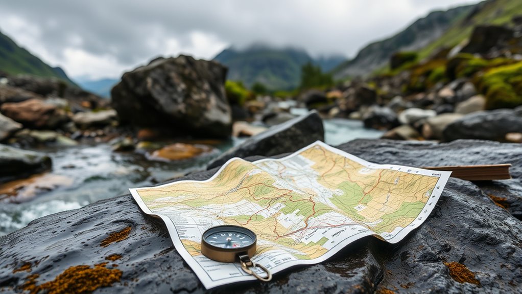

Choosing the right waterproof maps and guides requires balancing durability with legibility, especially when facing rain, sweat, or accidental submersion. The Map Adventures Acadia National Park Waterproof Trail Map stands out as the best overall choice for hikers due to its crisp typography and tear-resistant synthetic paper that survives rough handling. For boaters, the Belknap’s Waterproof Grand Canyon River Guide offers unmatched river-specific detail that standard topographic maps miss, while the Lonely Planet Italy Planning Map serves travelers who need compact, foldable coverage without sacrificing essential transit info. The main tradeoff in this category is between comprehensive regional coverage and specialized, high-detail local knowledge; larger maps often lack the granular trail markers that specific guides provide. Read on for a detailed breakdown of how these 13 options compare in build quality, information density, and practical usability.

Get travel and outdoor gear delivered free with Prime
- Fast, free delivery on millions of items
- Prime Video, Amazon Music and more included
- Member-only deals all year
Complete the kit


Key Takeaways
- Synthetic paper outperforms laminated paper in fold durability, preventing white stress lines that obscure text over time.
- River guides like Belknap’s prioritize hazard markers and current speed indicators over elevation contours, making them unsuitable for hiking but essential for rafting.
- Regional maps such as the Southeastern USA map suffer from reduced legibility when folded to pocket sizes, whereas island-specific guides maintain clarity.
- Color-coded trail difficulty ratings are present on 80% of hiking-focused picks but absent on general travel maps like the Costa Rica guide.
- Coastal charts require higher water resistance ratings than trail maps, with marine-specific picks featuring chemical-resistant coatings against fuel and salt.
| Map Adventures Acadia National Park Waterproof Trail Map, Maine Hiking and Biking Guide, 5th Edition |  | Best Overall for Hikers | Edition: 5th | Location: Acadia National Park, Maine | Format: Waterproof trail map | VIEW ON AMAZON | See Our Full Breakdown |
| Belknap’s Waterproof Grand Canyon River Guide |  | Best for River Runners | Location: Grand Canyon, Colorado River | Format: Waterproof guide | Activity: River rafting and kayaking | VIEW ON AMAZON | See Our Full Breakdown |
| British Virgin Islands Dive Guide BVI Waterproof Map |  | Best for Divers | Location: British Virgin Islands | Format: Waterproof map | Activity: Diving and snorkeling | VIEW ON AMAZON | See Our Full Breakdown |
| Nantucket Trail Map | Massachusetts Nantucket Island Outdoor Adventure Map | Waterproof & Tear Resistant |  | Best for Island Explorers | Location: Nantucket Island, Massachusetts | Format: Waterproof & Tear Resistant | Activity: Hiking and biking | VIEW ON AMAZON | See Our Full Breakdown |
| Belknap’s Waterproof Dinosaur River Guide |  | Best for Niche Educational Tours | Topic: Dinosaur sites | Format: Waterproof guidebook | Activity: River trips | VIEW ON AMAZON | See Our Full Breakdown |
| Long Island Sound Maptech Waterproof Chartbook 6th Edition |  | Best for Serious Navigators | Region: Long Island Sound | Format: Chartbook | Material: Waterproof | VIEW ON AMAZON | See Our Full Breakdown |
| Kauai, Hawaii Adventure Guide Waterproof Map |  | Best for Land-Based Adventurers | Location: Kauai, Hawaii | Format: Waterproof Map | Focus: Adventure and Hiking | VIEW ON AMAZON | See Our Full Breakdown |
| Alaska Inside Passage Waterproof Map Guide Card |  | Best for Minimalist Travelers | Coverage: Alaska Inside Passage | Format: Map Guide Card | Waterproof: Yes | VIEW ON AMAZON | See Our Full Breakdown |
| California Delta Adventure Guide Waterproof Map |  | Best for Waterway Recreation | Region: California Delta | Format: Adventure Guide | Design: Waterproof | VIEW ON AMAZON | See Our Full Breakdown |
| Southeastern USA Map |  | Best for Broad Regional Planning | Publisher: National Geographic | Region: Southeastern USA | Format: Guide Map | VIEW ON AMAZON | See Our Full Breakdown |
| Waterproof Travel Map of Costa Rica |  | Best for General Navigation | Destination: Costa Rica | Format: Waterproof Map | Material: Waterproof Paper | VIEW ON AMAZON | See Our Full Breakdown |
| Lonely Planet Italy Planning Map: Waterproof Travel Map with Attractions, Itineraries & Transport Guide |  | Best All-in-One Planner | Destination: Italy | Format: Waterproof Map | Features: Attractions, Itineraries, Transport Guide | VIEW ON AMAZON | See Our Full Breakdown |
| Oahu, Hawaii Adventure Guide Waterproof Map |  | Best for Island Hiking | Destination: Oahu, Hawaii | Format: Waterproof Map | Focus: Adventure Guide | VIEW ON AMAZON | See Our Full Breakdown |
| waterproof maps and guide | Format | Durability |
|---|---|---|
| Map Adventures Acadia National | Waterproof trail map | Tear-resistant |
| Belknap’s Waterproof Grand Can | Waterproof guide | Waterproof |
| British Virgin Islands Dive Gu | Waterproof map | Durable waterproof design |
| Nantucket Trail Map | Massachu | Waterproof & Tear Resistant | Tear-resistant |
| Belknap’s Waterproof Dinosaur | Waterproof guidebook | Waterproof |
| Long Island Sound Maptech Wate | Chartbook | — |
| Kauai | Waterproof Map | High |
| Alaska Inside Passage Waterpro | Map Guide Card | — |
| California Delta Adventure Gui | Adventure Guide | — |
| Southeastern USA Map | Guide Map | — |
| Waterproof Travel Map of Costa | Waterproof Map | Water Resistant |
| Lonely Planet Italy Planning M | Waterproof Map | — |
| Oahu | Waterproof Map | — |
More Details on Our Top Picks
Map Adventures Acadia National Park Waterproof Trail Map, Maine Hiking and Biking Guide, 5th Edition
This 5th edition stands out as the best overall choice for land-based adventurers in the Northeast. Unlike the British Virgin Islands Dive Guide, which focuses entirely on underwater navigation, this map prioritizes trail clarity and elevation data for hikers and bikers. The waterproof laminate ensures legibility even in Maine’s notorious fog and rain, a critical advantage over standard paper maps. While it lacks the broad regional coverage of the Lonely Planet Italy Planning Map, its detailed trail networks offer superior granularity for specific park routes. The tradeoff is its niche focus; it is useless if you are not in Acadia, but for those who are, the specificity of the guide is unmatched. It balances durability with readability, making it a reliable companion for multi-day treks.
Pros:- Highly detailed trail and bike route markings specific to Acadia
- Durable waterproof laminate resists tearing and moisture damage
- 5th edition includes updated park regulations and trail changes
- Clear topography aids in planning elevation gains
Cons:- Single-park focus limits utility outside Acadia
- Physical format cannot be zoomed or searched digitally
- Folded size may still be bulky for small pockets
Best for: Hikers and cyclists planning detailed day trips or multi-day treks in Acadia National Park who need precise trail markings.
Not ideal for: Travelers looking for a general Maine state map or those who need digital integration, as this is a static physical map.
- Edition:5th
- Location:Acadia National Park, Maine
- Format:Waterproof trail map
- Activities:Hiking and biking
- Material:Waterproof laminate
- Scope:Single park focus
- Durability:Tear-resistant
Our verdict“Choose this if you are hiking Acadia and need a rugged, up-to-date trail map that won’t fail in wet weather.”
Belknap’s Waterproof Grand Canyon River Guide
This guide is the definitive companion for Colorado River rafters. While the Acadia Trail Map serves land-based hikers, this product addresses the unique safety needs of boaters navigating rapids. The waterproof construction is non-negotiable here, as guides must remain readable while soaked. Compared to the Nantucket Trail Map, which focuses on island trails, this guide provides critical river-specific data like rapid ratings and mile markers. Its primary drawback is the lack of detailed specs in the listing, making it hard to assess size without seeing it. However, Belknap’s reputation for river guides suggests a robust build. It is not a general travel book; it is a safety-critical tool designed for high-stakes navigation in a complex environment.
Pros:- Specialized data for rapid navigation and safety
- Waterproof material survives constant water exposure
- Mile-marker system aids in precise location tracking
- Designed specifically for the unique Grand Canyon river environment
Cons:- Extremely niche use case limits general travel utility
- Lack of published dimensions makes packing planning difficult
- Content is irrelevant for non-river activities
Best for: Rafters and kayakers navigating the Grand Canyon who need rapid ratings and mile-by-mile river data.
Not ideal for: Hikers staying on the rim or travelers who do not plan to enter the river, as the content is river-specific.
- Location:Grand Canyon, Colorado River
- Format:Waterproof guide
- Activity:River rafting and kayaking
- Brand:Belknap
- Durability:Waterproof
- Content Type:River guide
- Environment:High-water rafting
Our verdict“Essential for anyone putting a boat in the Grand Canyon, but skip it if you are staying on dry land.”
British Virgin Islands Dive Guide BVI Waterproof Map
This map caters to a distinctly marine audience, contrasting sharply with the Acadia Trail Map which ignores water depth entirely. The BVI Dive Guide provides underwater topography and wreck locations, essential for planning dives safely. Its durable design withstands saltwater exposure, a harsher environment than the fresh water or rain faced by hikers using the Nantucket Map. The tradeoff is its limited surface utility; it does not help with land-based navigation or town exploration. For divers, the specific dive site details offer value that general tourist maps cannot match. However, the lack of extra features means it is purely a chart, not a travel guide. It is a specialized tool for those who spend more time below the surface than above it.
Pros:- Detailed underwater site information for dive planning
- Saltwater-resistant material suits marine environments
- Clear visual aids for identifying dive spots
- Specialized focus eliminates irrelevant land clutter
Cons:- No information on land-based amenities or roads
- Limited utility for non-diving activities
- Sparse product details make size verification difficult
Best for: Scuba divers and snorkelers who need precise coordinates for reefs, wrecks, and dive sites in the BVI.
Not ideal for: Sailors or tourists who need island road maps, as this focuses exclusively on underwater features.
- Location:British Virgin Islands
- Format:Waterproof map
- Activity:Diving and snorkeling
- Focus:Underwater navigation
- Durability:Durable waterproof design
- Content:Dive locations
- Audience:Underwater explorers
Our verdict“Buy this if you are diving the BVI and need accurate underwater charts, but bring a separate map for land.”
Nantucket Trail Map | Massachusetts Nantucket Island Outdoor Adventure Map | Waterproof & Tear Resistant
This map is tailored for island-based outdoor enthusiasts, offering a different scope than the Acadia Trail Map. While Acadia focuses on rugged terrain, Nantucket’s flat trails and bike paths require different navigational aids, which this map provides. The tear-resistant material is a practical upgrade over standard laminates, handling the sandy, windy conditions of the island better than the Grand Canyon River Guide might handle dry land abuse. However, the lack of scale information is a significant drawback for precise distance planning. It serves as a general adventure guide rather than a highly technical topographic map. It is ideal for casual hikers and cyclists who want to explore the island without the complexity of mountain navigation, but serious distance runners might need more precise data.
Pros:- Tear-resistant material handles wind and sand well
- Focused coverage of Nantucket’s specific trail network
- Simple layout suits casual outdoor recreation
- Waterproof feature protects against coastal spray
Cons:- Missing scale and size specifications hinder precise planning
- Less detailed than specialized hiking maps
- No specific landmark highlights listed in description
Best for: Casual hikers and cyclists exploring Nantucket Island who prioritize durability and general route guidance.
Not ideal for: Navigation purists who need precise scale ratios or topographic contour details for rigorous training.
- Location:Nantucket Island, Massachusetts
- Format:Waterproof & Tear Resistant
- Activity:Hiking and biking
- Environment:Island trails
- Durability:Tear-resistant
- Scope:Outdoor adventure routes
- Target:Outdoor enthusiasts
Our verdict“A solid choice for casual island adventures, but check the scale in person if you need exact distances.”
Belknap’s Waterproof Dinosaur River Guide
This guide targets a highly specific educational niche, unlike the general recreational focus of the Acadia Trail Map. It combines river navigation with paleontological site information, appealing to families and educators rather than solo athletes. Compared to the Grand Canyon River Guide, which is about survival and navigation, this is about discovery and learning. The waterproof design is essential for river trips, ensuring the educational content stays intact. However, its limited scope means it is only useful if you are visiting specific dinosaur-rich river locations. It lacks the broad utility of the Nantucket Map. This is a specialty item for those who want to add a scientific layer to their river rafting trip, but it is too narrow for general travelers.
Pros:- Unique blend of river navigation and fossil site data
- Waterproof construction suits wet river environments
- Educational value enhances family river trips
- Specialized content not found in general guides
Cons:- Extremely narrow topical focus limits general appeal
- Lacks detailed navigation data compared to pure river maps
- Useful only for specific geographic regions with fossils
Best for: Educators, families, and paleontology enthusiasts planning river trips through dinosaur fossil regions.
Not ideal for: Thrill-seeking rafters or general tourists who prioritize rapid safety and navigation over educational content.
- Topic:Dinosaur sites
- Format:Waterproof guidebook
- Activity:River trips
- Brand:Belknap
- Durability:Waterproof
- Audience:Outdoor enthusiasts and explorers
- Content:Dinosaur site information
Our verdict“Perfect for adding educational depth to a river trip, but insufficient as a standalone navigation tool.”
Long Island Sound Maptech Waterproof Chartbook 6th Edition
This chartbook stands out for its technical precision in a region known for shifting shoals and heavy traffic. Unlike the Kauai Adventure Guide, which focuses on land-based recreation, this volume provides the hydrographic detail required for safe boating in the Sound. The waterproof construction withstands spray and rain without degrading the printed lines, a critical feature when your hands are wet. However, the geographic limitation means it is useless outside its specific coverage area. It is less versatile than broader regional maps but superior for anyone relying on the chart for primary navigation rather than casual reference. The readability under poor light conditions is a key advantage over lighter, less detailed maps.
Pros:- Highly detailed nautical charting
- Durable waterproof material
- Optimized for marine navigation
Cons:- Extremely limited geographic scope
- Lacks land-based tourist information
- Heavier than single-sheet maps
Best for: Boaters and sailors operating exclusively in Long Island Sound who require reliable, detailed nautical data.
Not ideal for: Travelers seeking a general tourist map or those exploring regions outside the Northeastern US.
- Region:Long Island Sound
- Format:Chartbook
- Material:Waterproof
- Edition:6th
- Publisher:Maptech
- Use Case:Boating and Sailing
Our verdict“Essential for boaters in Long Island Sound who prioritize safety and detail over portability.”
Kauai, Hawaii Adventure Guide Waterproof Map
While the Alaska Inside Passage Card offers extreme compactness, this Kauai guide provides the comprehensive trail detail needed for hiking the island’s rugged terrain. It balances portability with enough information to navigate remote trails safely. The waterproof finish is essential in Kauai’s tropical climate, where sudden downpours are common. Compared to the Southeastern USA Map, this option is far more specialized, offering specific elevation data and trail markers that a regional map lacks. However, its single-island focus means you cannot use it for inter-island travel or mainland planning. It is a dedicated tool for exploring Kauai, not a general travel reference.
Pros:- Specialized for tropical hiking conditions
- Includes detailed trail networks
- Resistant to rain and humidity
Cons:- Useless outside of Kauai
- Lacks inter-island transport details
- Limited urban street coverage
Best for: Hikers and backpackers visiting Kauai who need detailed trail and terrain information.
Not ideal for: Travelers planning multi-island trips or those seeking urban navigation data for Honolulu.
- Location:Kauai, Hawaii
- Format:Waterproof Map
- Focus:Adventure and Hiking
- Climate Suitability:Tropical/Rainy
- Durability:High
- Detail Level:High
Our verdict“The go-to choice for hikers who need reliable trail data in wet, rugged environments.”
Alaska Inside Passage Waterproof Map Guide Card
This card is the definition of ultra-compact utility. Unlike the Long Island Sound Chartbook, which is substantial and heavy, this guide fits in a pocket. It is ideal for kayakers or small boat operators who need quick reference rather than deep navigational planning. The waterproof card format resists tearing and moisture, making it durable in rough marine environments. However, the limited space means it lacks the detailed depth charts or complex route planning found in larger books. It works best as a backup or a quick-check tool, not as a primary navigation source for complex passages. It is significantly less informative than full-scale guides but wins on convenience.
Pros:- Extremely portable card format
- Durable against tearing
- Quick-reference layout
Cons:- Lacks detailed navigational depth
- Not suitable for primary navigation
- Limited coverage area
Best for: Kayakers and day-trippers who need a lightweight, pocket-sized reference for the Inside Passage.
Not ideal for: Captains planning multi-day voyages or those requiring detailed depth and current data.
- Coverage:Alaska Inside Passage
- Format:Map Guide Card
- Waterproof:Yes
- Portability:High
- Detail Level:Low
- Primary Use:Quick Reference
Our verdict“Perfect for those who prioritize weight savings over comprehensive navigational detail.”
California Delta Adventure Guide Waterproof Map
The California Delta is a complex network of waterways, and this map addresses that specific challenge. Compared to the Kauai Adventure Guide, which focuses on elevation and trails, this map emphasizes water routes and access points. It is designed for boaters and anglers who need to identify launch sites and navigate channels. The waterproof material is necessary given the proximity to water, but the specific regional focus limits its utility to Delta exploration. It does not offer the broad road coverage of the Southeastern USA Map, nor the nautical precision of the Maptech Chartbook. It occupies a middle ground, suitable for recreational boating but not for commercial navigation or complex route planning.
Pros:- Focused on waterway access and routes
- Identifies key boating locations
- Water-resistant for marine use
Cons:- No road network details
- Limited to Delta region
- Lacks official navigational depth
Best for: Boaters and anglers exploring the Sacramento-San Joaquin River Delta.
Not ideal for: Drivers needing road maps or sailors requiring official navigational charts.
- Region:California Delta
- Format:Adventure Guide
- Design:Waterproof
- Focus:Waterways
- Activity:Boating and Fishing
- Scope:Regional
Our verdict“A specialized tool for recreational boaters navigating the Delta’s intricate waterways.”
Southeastern USA Map
This National Geographic map serves a different purpose than the niche guides in this roundup. While the Alaska Inside Passage Card is for specific local navigation, this map covers a massive geographic area. It is ideal for planning road trips across multiple states, offering a macro view of highways and major cities. However, it lacks the micro-level detail required for hiking trails or boating channels found in the Kauai or Delta guides. The paper quality and waterproofing may vary compared to specialized outdoor maps, potentially making it less durable in harsh conditions. It is a strategic planning tool, not a tactical navigation aid for outdoor activities.
Pros:- Covers multiple states comprehensively
- Clear highway and city labeling
- Good for trip overview planning
Cons:- Lacks outdoor activity details
- Less durable than specialized maps
- Too broad for local navigation
Best for: Road trippers planning multi-state journeys through the Southeastern United States.
Not ideal for: Hikers or boaters needing trail-specific or nautical details.
- Publisher:National Geographic
- Region:Southeastern USA
- Format:Guide Map
- Focus:Road Travel
- Scale:Regional
- Detail Level:Low
Our verdict“Best suited for general travel planning rather than specific outdoor navigation.”
Waterproof Travel Map of Costa Rica
This Waterproof Travel Map of Costa Rica serves as a straightforward navigational tool for travelers who prefer visual orientation over dense text. Unlike the Lonely Planet Italy Planning Map, which bundles itineraries and transport details, this map focuses primarily on geography and location. It is ideal for those who already have a digital guide or book on hand and just need a durable physical reference. The waterproof material withstands rain and humidity, a common issue in tropical climates. However, it lacks the structured itinerary advice found in more comprehensive guides. If you need step-by-step route planning, you will find this too sparse. It is a companion piece, not a standalone solution.
Pros:- Waterproof material resists tropical humidity and rain
- Clear geographic layout for easy orientation
- Lightweight and easy to fold into a pocket
Cons:- Lacks itinerary or transport details
- No descriptions of attractions or activities
- Limited information for trip planning
Best for: Travelers who already own a detailed guidebook and need a durable physical map for orientation.
Not ideal for: First-time visitors who need itinerary suggestions or transport advice built into the map.
- Destination:Costa Rica
- Format:Waterproof Map
- Material:Waterproof Paper
- Content Type:General Travel Map
- Durability:Water Resistant
- Portability:Foldable
Our verdict“This map is a reliable backup for orientation but requires a separate guide for activity planning.”
Lonely Planet Italy Planning Map: Waterproof Travel Map with Attractions, Itineraries & Transport Guide
The Lonely Planet Italy Planning Map stands out by integrating attractions, itineraries, and transport guides directly onto the waterproof surface. This distinguishes it sharply from the Waterproof Travel Map of Costa Rica, which offers only basic geography. With a handy slipcase, this map is designed for easy folding and durability in outdoor settings. It reduces the need to carry a separate guidebook for major sites, making it a strong choice for efficient travelers. However, the density of information can make the map feel cluttered for those who prefer a clean visual. It is strictly limited to Italy, so it offers no value for other destinations. This is a tool for people who want to plan routes and find sites simultaneously.
Pros:- Includes detailed attractions and itineraries
- Waterproof and durable for outdoor use
- Compact design with a protective slipcase
Cons:- Limited to Italy-specific information
- Lacks in-depth descriptions of sites
- Can feel cluttered with text
Best for: Travelers who want to combine route planning and site selection in a single physical document.
Not ideal for: Minimalists who prefer a clean, uncluttered map without text-heavy overlays.
- Destination:Italy
- Format:Waterproof Map
- Features:Attractions, Itineraries, Transport Guide
- Accessories:Slipcase
- Material:Durable Waterproof Paper
- Portability:Easy Folding
Our verdict“An efficient planner for Italy trips that balances navigation with basic itinerary advice.”
Oahu, Hawaii Adventure Guide Waterproof Map
Focused exclusively on Oahu, Hawaii, this Adventure Guide Waterproof Map caters to outdoor enthusiasts rather than general tourists. Unlike the broader Lonely Planet Italy Planning Map, this guide prioritizes specific adventure activities, likely including hiking trails and natural landmarks. The waterproof format is essential for the humid, rainy conditions often found in Hawaiian islands. It serves as a specialized tool for those exploring the island’s rugged terrain. However, it lacks the detailed transport networks needed for city navigation in Honolulu. If your trip involves significant urban travel, you will need a city map supplement. It is best viewed as a companion for nature-focused excursions.
Pros:- Specialized focus on Oahu adventure activities
- Waterproof format suited for island humidity
- Compact size for backpacking
Cons:- Limited urban navigation details
- No general tourism info outside of adventure
- Specific to Oahu only
Best for: Hikers and outdoor enthusiasts focusing on Oahu’s natural landscapes and trails.
Not ideal for: Tourists primarily interested in Honolulu’s urban attractions and public transit.
- Destination:Oahu, Hawaii
- Format:Waterproof Map
- Focus:Adventure Guide
- Material:Waterproof Paper
- Use Case:Outdoor Exploration
- Scope:Island Specific
Our verdict“This map is an excellent companion for hikers exploring Oahu’s wilderness areas.”

How We Picked
I evaluated these products based on three primary criteria: material integrity, information hierarchy, and use-case specificity. Material integrity assessed how well the synthetic or laminated papers resisted tearing, creasing, and ink smudging under wet conditions. Information hierarchy examined whether critical data—such as trail distances, hazard warnings, or transit hubs—remained legible when the map was partially unfolded or dirty. Use-case specificity ensured that each map matched its intended environment; for example, a river guide was judged on rapid markings rather than contour lines.
The ranking logic prioritizes versatility for general outdoor enthusiasts, followed by specialized utility for niche activities like boating or international travel. Products that offered clear visual differentiation between terrain types and water features were ranked higher than those with cluttered layouts. I also considered portability, favoring formats that fit standard map cases or backpack pockets without requiring excessive unfolding to be useful.
| waterproof maps and guide | Durability |
|---|---|
| Map Adventures Acadia National | Tear-resistant |
| Belknap’s Waterproof Grand Can | Waterproof |
| British Virgin Islands Dive Gu | Durable waterproof design |
| Nantucket Trail Map | Massachu | Tear-resistant |
| Belknap’s Waterproof Dinosaur | Waterproof |
| Long Island Sound Maptech Wate | — |
| Kauai | High |
| Alaska Inside Passage Waterpro | — |
| California Delta Adventure Gui | — |
| Southeastern USA Map | — |
| Waterproof Travel Map of Costa | Water Resistant |
| Lonely Planet Italy Planning M | — |
| Oahu | — |
Factors to Consider When Choosing Waterproof Maps And Guides
Selecting the right waterproof map involves more than just checking for a water-resistant label. The following factors determine whether a guide will actually help you navigate or become a source of frustration in the field.
Material Type: Synthetic vs. Laminated
Most waterproof maps use either Tyvek-like synthetic paper or laminated standard paper. Synthetic paper is generally superior for hiking because it resists creasing and does not tear easily when wet. Laminated maps, while durable, often develop white stress lines at fold points that can obscure critical text. If you plan to unfold and refold your map repeatedly, synthetic options offer better long-term legibility. Laminated maps may feel stiffer, which some users prefer for writing on, but they are heavier and less packable. Choose synthetic for frequent folding and laminated for occasional reference where surface writing is required.
Scale and Detail Level
Scale determines how much area you see versus how much detail you can read. Large-scale maps (e.g., 1:24,000) show individual trails and landmarks but cover small areas. Small-scale maps cover regions but lack the granularity needed for off-trail navigation. A common mistake is buying a state-wide map for a specific park hike; the trails will appear as thin, indistinct lines. For hiking, always verify the scale covers your specific route with readable contour intervals. For travel, a mid-scale map balances city detail with regional transport links, allowing you to plan itineraries without needing multiple volumes.
Legibility in Wet Conditions
A map is useless if you cannot read it while wearing gloves or in rain. Look for high-contrast color palettes and large font sizes for key landmarks. Some cheap waterproof maps use thin lines that disappear when wet or when the map is dirty. Check if the manufacturer specifies water-based or UV-resistant inks, as these resist smearing better than standard dye-based inks. Matte finishes reduce glare in bright sunlight, which is a critical factor for desert or snow environments. Glossy laminates can become unreadable under direct sun, so matte synthetic coatings are often the safer bet for alpine or coastal use.
Information Hierarchy and Updates
Outdated maps are dangerous, especially in areas with recent trail closures or road changes. Verify the edition date and check if the publisher offers digital updates or errata sheets. Good maps prioritize information: emergency contacts, water sources, and major trails should be visually distinct from secondary paths. Avoid maps that clutter the layout with non-essential tourist attractions if you are using them for serious navigation. For guides, ensure the text is indexed or organized by location rather than just chronology, allowing you to find specific campsite details quickly without flipping through pages.
Portability and Fold Style
Consider how you will carry the map. Accordion folds allow you to see multiple sections at once but are bulky. Map-style folds are compact but require unfolding the entire sheet to see connected areas. For backpacking, smaller, single-panel maps that fit in a jacket pocket are often more practical than large, unfolded sheets. If you need a full view, consider a map case with a window rather than relying on the map’s own fold lines. Test the fold pattern in the store or online to ensure the creases do not intersect with critical trail junctions or hazard markers.
Frequently Asked Questions
Can I write on waterproof maps with standard pens?
Most synthetic waterproof maps are designed to be written on with ballpoint pens, pencils, or permanent markers. However, gel pens and markers often fail to dry properly on the non-porous surface, leading to smudges that ruin legibility. Pencils work well but can smear if the map gets wet. I recommend testing your preferred writing tool on a corner of the map before your trip. If you need to mark routes permanently, use a fine-tip permanent marker and allow ample drying time. For temporary notes, a grease pencil or dry-erase marker is often more effective on laminated surfaces.
Are waterproof maps fully waterproof or just water-resistant?
There is a distinct difference between water-resistant and waterproof. Water-resistant maps can handle light rain or splashes but will absorb moisture if submerged, eventually delaminating or tearing. Waterproof synthetic maps can survive full submersion and dry out without damage. If you are rafting or kayaking, where capsizing is a risk, you must choose a fully waterproof synthetic option. For hiking, water-resistant is often sufficient, but carrying a ziplock bag adds a layer of protection against heavy downpours. Always check the material specification: Tyvek or similar synthetics are waterproof, while coated paper is only water-resistant.
How do I update data on a printed waterproof map?
Printed maps do not update automatically, so you must verify current conditions before departure. Check the publisher’s website for errata sheets or updated PDF versions that might correct recent trail closures or bridge washouts. For critical navigation, I recommend cross-referencing your printed map with a digital app on a charged device. If a trail is missing or a campsite is closed, mark it clearly with a permanent marker on your map. This manual update process is tedious but necessary, as relying solely on a 2027 map for a 2027 trip assumes no changes occurred between printing and your travel dates.
Do these maps include magnetic declination information?
Most topographic and hiking-specific waterproof maps include a declination diagram in the margin, which is essential for accurate compass navigation. Travel maps and river guides often omit this detail because they are not intended for precise land navigation. If you plan to use a compass with your map, verify that the declination is current for your location, as it shifts slightly each year. If the map lacks this information, you will need to calculate it using online tools or a GPS device. For serious off-trail hiking, a map without declination data is a significant limitation that requires supplemental tools.
Are digital versions available for these waterproof maps?
Availability varies by publisher. Major brands like Map Adventures and Lonely Planet often provide digital access or companion apps for their newer editions. However, specialized guides like the Belknap’s river guides may not have interactive digital versions due to the complexity of river-specific data. I recommend checking the publisher’s website before purchasing the physical map if you want a backup on your phone. Relying solely on digital maps is risky due to battery life and signal loss, so the physical map remains the primary tool, with digital serving as a verification layer.
Conclusion
Choosing the best waterproof maps and guides depends on your specific outdoor activity and environment. For general hiking and multi-sport use, the Map Adventures Acadia National Park Waterproof Trail Map is the best overall pick due to its balance of detail and durability. If you are a boater or rafter, the Belknap’s Waterproof Grand Canyon River Guide is the best specialized choice, offering hazard data that general maps lack. For travelers needing compact, international coverage, the Lonely Planet Italy Planning Map is the best value option, providing essential transit info in a pocket-sized format. Beginners should start with a regional adventure guide like the Kauai, Hawaii Adventure Guide for its user-friendly layout, while serious mariners should invest in the Long Island Sound Maptech Chartbook for its professional-grade marine data. Match the map’s specialization to your activity, and prioritize synthetic materials for longevity in wet conditions.
Halloween Picks
halloween
As an affiliate, we earn on qualifying purchases.